INFOS & SERVICE
Unsere anderen Webseiten

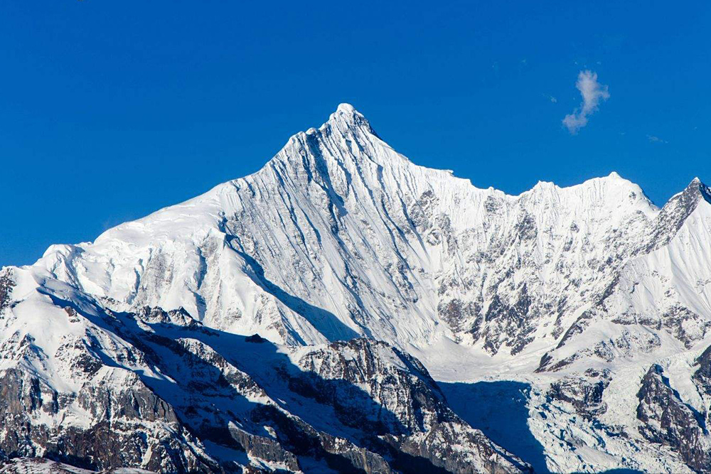
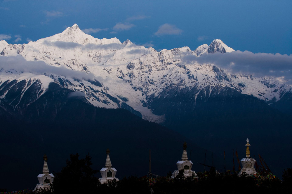
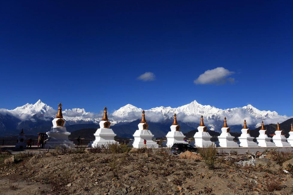
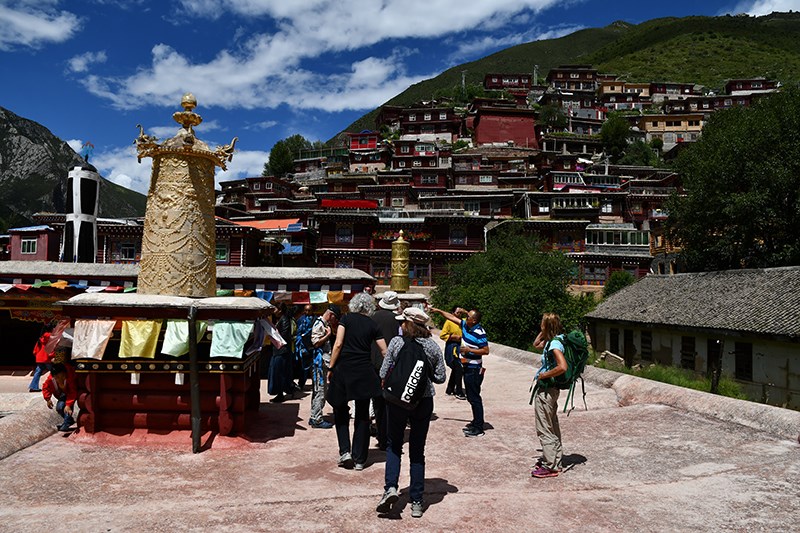
Moirigkawagarbo Berg
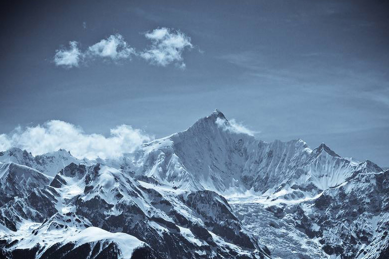
At the place where the northwest part of Yunnan Province and the southeast part of the Tibet Autonomous Region meet, the vast and boundless Nu Shan extends from the north to the south. The north section of the Nujiang River, where Yunnan Province and Tibet have their common boundary, has Zayu County of the Tibet Autonomous Region on its west side, and Yunling and Foshan in Deqen County of Yunnan Province on its east side, ranging from 98°30'N - 98°52'E to 28°16' N - 28°33'E. The north section of the Nujiang River is 30 kilometers long from the north to the south and 36 kilometers wide from the west to the east, and is named Taizi Xueshan (the snowy mountain of crown prince). Its main peak is Moirigkawagarbo, which, called "Kagebo" by the Tibetan compatriots, proves to be the highest peak in Yunnan Province.
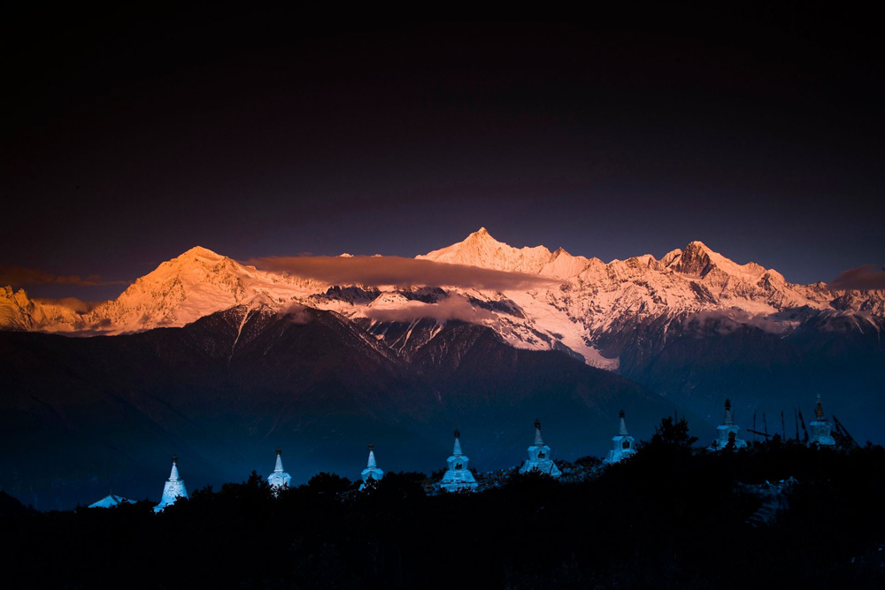
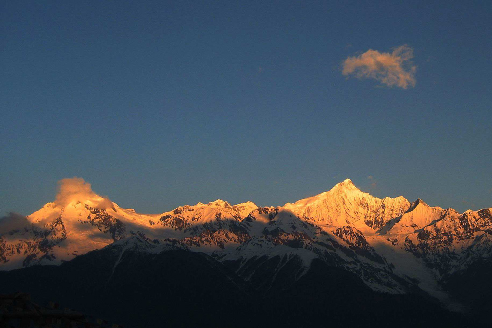
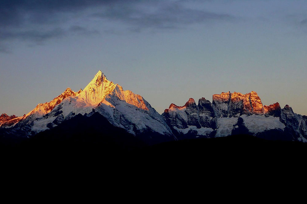
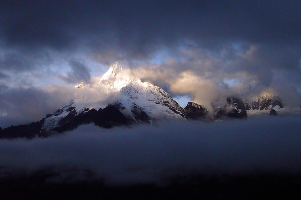
In Tibetan language, "Kagebo Feng" means "the White snowy mountain", which is looked up by the Tibetan compatriots as one of the "Eight Buddist Mountains", "the Divine Mountain and Holy Land". Every year, the Buddist followers from Tibet, Sichuan, Yunnan and Qinghai trek for thousands of miles to pay religious homage to it. Rising 6740 meters above sea level, Moirigkawagarb is located at 98.6°E and 28.4°N which is on the main ridge line of the Nushan Mountain Ridges. Here, the height difference between the peak top and the Mingyong River mouth by the Lancang Jiang River at the mountain foot (2038 meters above sea level) measures 4700 meters. Due to the steep lie of the mountain, Moirghawagarbo is 360 meters higher with an average advance-forward of 1 kilometer within the horizontal distance of 14 kilometers. The Mirigkawagerbo is engulfed by over 20 peaks capped by snow all year round, 6 of which exceed 6000 meters above sea level.
The geography of the Crown Prince Snowy Mountain being higher in the north and lower in the south, its river valley is so widely open in the south that air current can go up along the valley. As a result, the Moirigkawagarbo area is under the strong effect of the monsoon and has marked difference between the dry and humid seasons. In addition to that, the high and steep mountains helps to produce perpendicular climatic belts with utterly different features. Above the neve snowline of 4000 meters above sea level, the tall and steep white snowy peaks are veiled in the rosy clouds which are slowly rising, while in the valley, the glaciers extend dozens of kilometers, presenting a magnificent view. The larger glaciers are Nu Qa, Si Qa , Mingyong Qa. Below the snowline, the mountain slopes on both sides of the glaciers are blanketed by dense alpine shrubs and conifer forests, which are luxiant and in bright colors reflected by white snow. The fertile natural grass with such wild animals as bamboo patridges, river deer, lesser pandas, mules and bears are moving about there. Moreover, the high mountains and grassy marshland abound in such precious herbal medicines as Chinese catepillar fungus (Cordyceps sinensis) and fritillary. Besides its complicated geography, the climate here are even more complicated and capricious. In summer time each year, the air temperature of the river valleys at the mountain foot may reach 11 ~ 29℃ while that of the high mountains may be as low as -10 ~ -20℃. The yearly precipitation of 600 mm on the average are mainly concentrated in the months of June - August, during which time the extremely unstable climate poses great difficulties for mountaineering activities and make it the forbidden season. Comparatively more stable as it is in winter as against that in summer, the climate is still puzzling and unpredictable. On January 3, 1991, the Allied a mountaineering Team of China-Japan met with such an unexpectedly violent snow avalanche at night that the campsite vanished without any trace the next morning and all the 17 mountaineers died in the accident. This proves to be a tragedy rarely experienced by man in the mountaineering history.
The route line to the mountain. First, drive for 849 kilometers from Kunming along the Yunnan - Tibet Highway to the county of Deqen. Then, make your way along the simply-built Highway to Yongzhong or Sinong. From here, ride on horse back or by richshaw, and you will get to the foot of the snowy peak which is on the to Niangya or Sinong.